Joseense companies: Amazonia 1
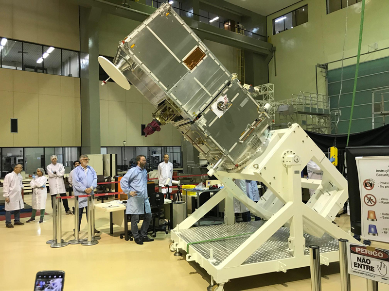
Photo: Disclosure
José Roberto Amaral
Secretariat of Innovation and Economic Development
The first remote sensing satellite designed, integrated and operated by Brazil, Amazonia 1 had the participation of seven companies located in São José dos Campos in its development and production, generating employment and income in the city.
Of the group of companies, five of them are linked to the Brazilian aerospace cluster of the Technological Park, created and supported by the City of São José. They are: AEL Sistemas, Equatorial Sistemas, Opto Eletrônica, Fibraforte and Omnisys.
The companies Orbital Engenharia and Cenic, also based in São José, were the other members of the satellite development project, led by Inpe (National Institute for Space Research) in partnership with the Brazilian Space Agency.
Amazonia 1 was successfully launched on Sunday by the PSLV (Polar Satellite Launcher Vehicle) launch vehicle from the Satish Dhawan Space Center in Sriharikota, India.
The satellite is part of the so-called Amazon Mission, created to provide remote sensing data to observe and monitor deforestation, especially in the Amazon region.
The mission will also monitor agriculture throughout the national territory, in addition to providing data on the coastal region, water reservoirs, forests and environmental disasters.
Founded in 2001 in Jardim das Indústrias in São José, Orbital Engenharia manufactured the solar energy generator for the Amazonia 1, essential equipment for its operation.
“When the satellite is injected into orbit, the solar panels need to come into operation. If they fail, it is the end of the mission”, says Celio Vaz, founder of Orbital.
He worked for 17 years at INPE as a satellite engineer before creating the company. Development of the generator, including design and manufacturing, took two years.
Cenic, which has a unit in Chácaras Reunidas, carried out durability and fatigue tests on products and equipment that make up the satellite.
technologic Park
The companies Equatorial Sistemas and Opto Eletrônica, located in the core of the Technological Park, developed the WIFI Camera, specially designed to monitor the Amazon and capture color images of areas of around 640 thousand km², reducing the time needed to cover the entire forest.
The companies also developed the Digital Data Recorder, a radiation-resistant device that records and stores image data collected at times when the satellite is out of visibility from stations on Earth, providing flexibility to the mission.
Omnisys, also resident in the Park, developed and produced the X-Band AWDT Transmitter and its Antenna, two technologies that allow sending satellite image data to reception stations on Earth.
The company Fibraforte, associated with the Brazilian Aerospace Cluster, developed the propulsion subsystem, responsible for changing the satellite’s speed, ensuring correct insertion and maintenance of its nominal orbit.
AEL Sistemas developed and manufactured the DC/DC converters, responsible for converting the electrical voltage levels necessary to power the satellite’s systems.
Training
According to experts, the participation of these companies is strategic and contributes to consolidating Brazilian knowledge in the complete cycle of satellite development.
For the Technology Park’s operations director, José Iram Barbosa, the project’s success proves Brazil’s capacity in developing space projects. “One of the great differences of Amazonia 1
Source: PMSJC – https://www.sjc.sp.gov.br